First Alert Weather: Timing and focus of heavier rains changing today.
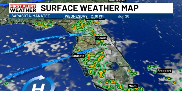
SARASOTA, Fla. (WWSB) - Today will be the start of a pattern shift that will last the rest of the work week and into the weekend. A trough of low pressure will weaken to our north and high pressure will build in over the Gulf of Mexico. As that high slides south of us our winds will begin to shift to a more westerly direction.
In summer, in Florida on a peninsula, the weather is, in large part, driven by the amount of moisture in the air and the wind direction. Today the increasingly west wind will favor a slightly earlier start to the rain and, pushing the storms east, favor the heaviest downpours inland and to the south. This pattern will become increasingly noticeable as winds become steadily out of the west or southwest in the days to come.
The shift to early showers and heavier storms inland and on the east coast will last into the weekend. Coastal areas will get a chance to dry out a bit.
As we go into next week, some uncertainty remains. Long range models build high pressure to our east in the Atlantic, which would return us to a more typical southeast pattern of late day inland storms that drift toward the west as they die out. However, complications arise as there are indications that at the same time some drier air may move in, limiting rain shower development.
Copyright 2024 WWSB. All rights reserved.


