Hurricane Helene Makes Landfall in Florida
Phenomena: Tropical Cyclones, Hurricanes
Satellite: GOES-16 (GOES East)
Product: GeoColor
Instrument: Advanced Baseline Imagery (ABI)
Date: Sept. 26, 2024
Time: 11:25 p.m. EDT
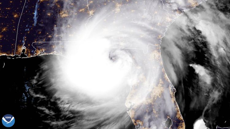
On Sept. 26, 2024, at 11:10 p.m. EDT, NOAA’s GOES East satellite captured Hurricane Helene making landfall near Perry, Florida, just east of the Aucilla River's mouth. With winds reaching 140 mph, the Category 4 storm ranks among the most powerful to strike the United States.
According to the National Weather Service Tallahassee, storm surge levels in parts of Taylor and Dixie counties from Helene were estimated to reach 15 feet, though it will take several weeks of analysis to confirm these measurements.
The GOES East geostationary satellite, also known as GOES-16, keeps watch over most of North America, including the contiguous United States and Mexico, as well as Central and South America, the Caribbean, and the Atlantic Ocean to the west coast of Africa. The satellite's high-resolution imagery provides optimal viewing of severe weather events, including thunderstorms, tropical storms, and hurricanes.


